
Preface
We first completed the Loowit Trail in August 2019, shortly after the Volcanic 50K. Several trip reports describe that period as one of the best times to attempt the loop because the trail has recently been maintained.
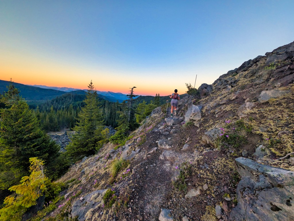
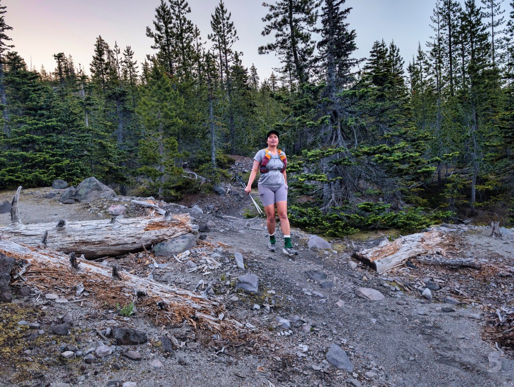
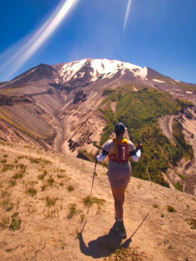
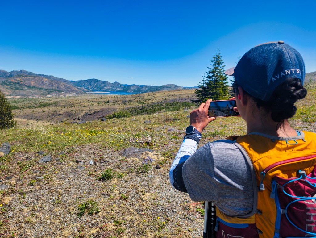
Our 2019 day was cloudy with drizzle throughout the day, and the temperature stayed around 64–65°F. We got almost no mountain views, but the cool weather made the exposed sections comfortable. We finished in 11 hours and 45 minutes. For trail conditions and weather, see the following pictures from 2019. Trails were super manicured and had minimum uneven surfaces.
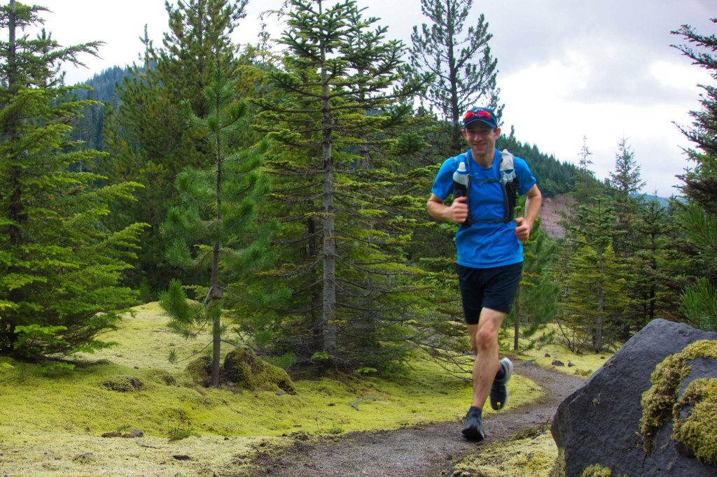
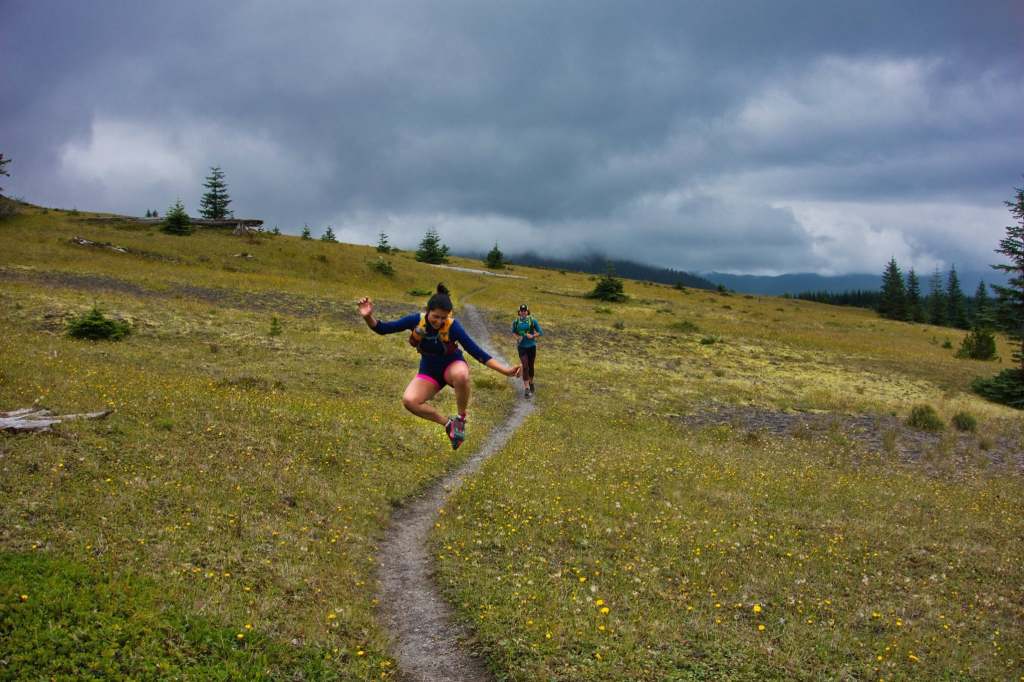
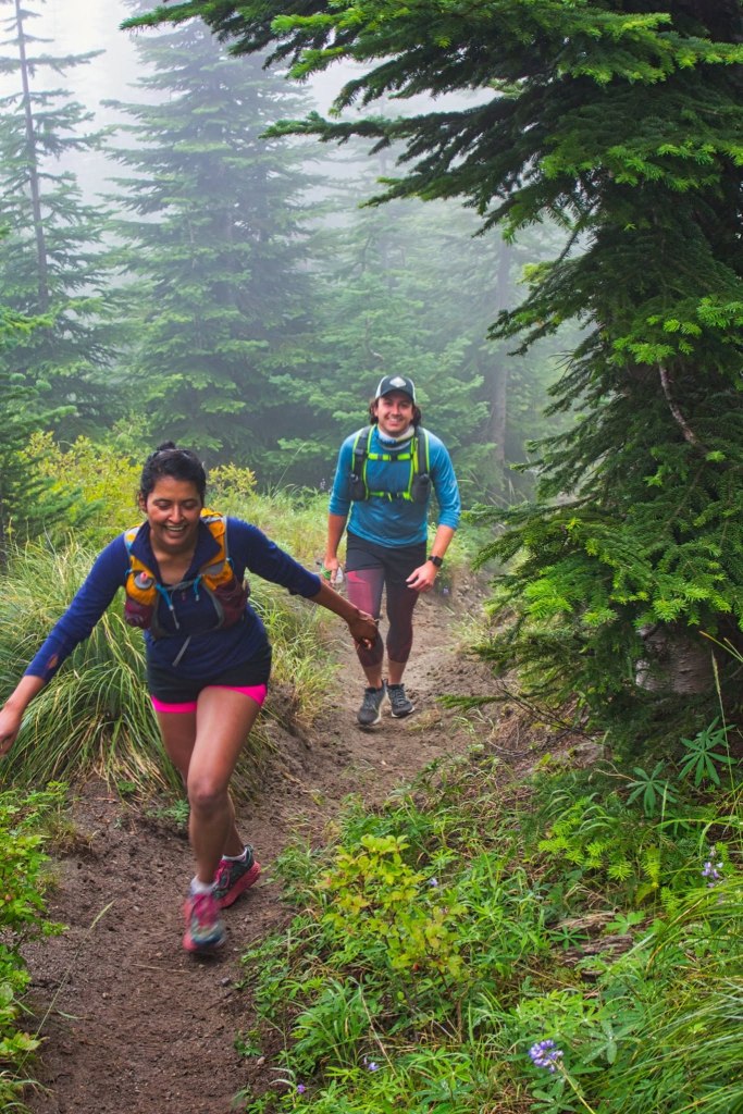
All of the above pictures are from our first Loowit run in Aug 2019
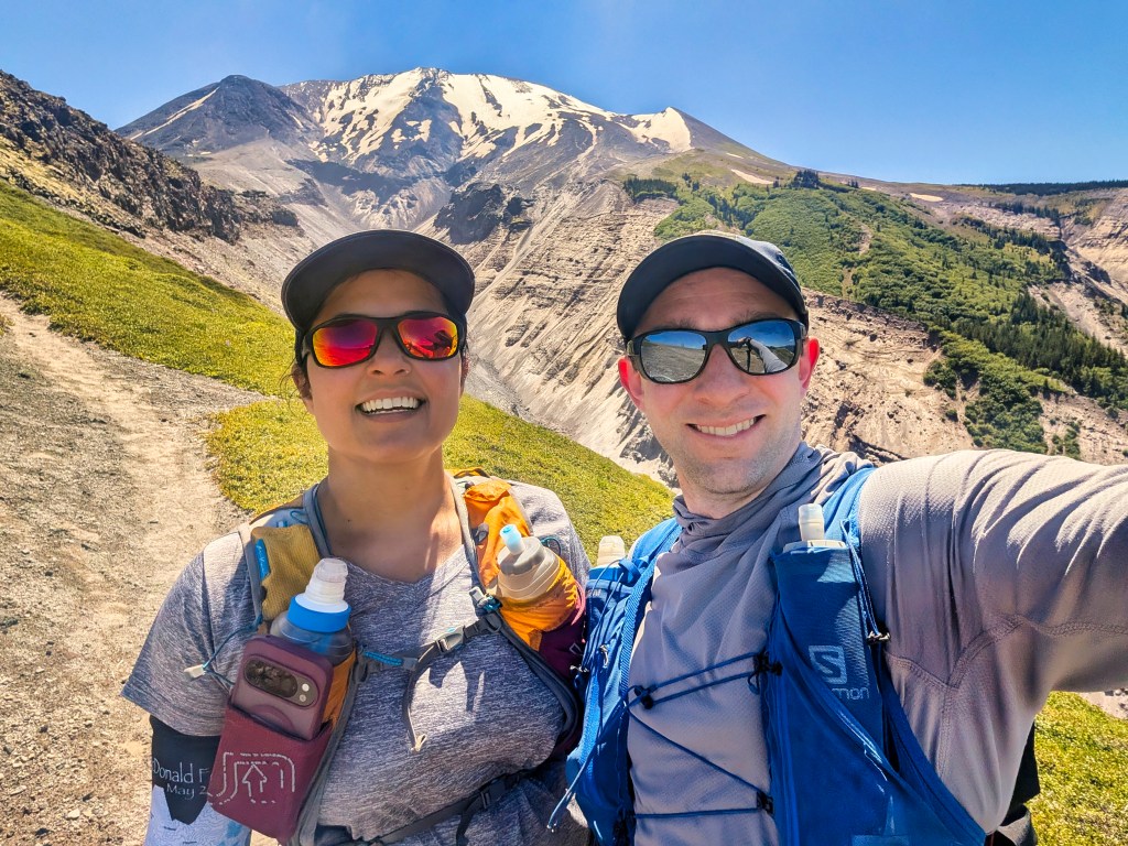
On June 13 2026, we returned with considerably better fitness, a 10-hour time goal, and apparently insufficient respect for what early-season volcanic terrain during a heatwave could do to that goal.
Portland reached 97°F that weekend. The forecast for the Loowit Trail showed a high of 75°F at elevation, but forecasts measure air temperature—not what it feels like while crossing sun-baked volcanic ash and rocks with almost no shade. On the northern and eastern sides, it felt closer to 90°F. Some of the rocks were hot to the touch.
Thankfully, we had a cool breeze for much of the day. Without it, this report might simply read: “We started the Loowit Trail and then moved permanently into the nearest creek.”
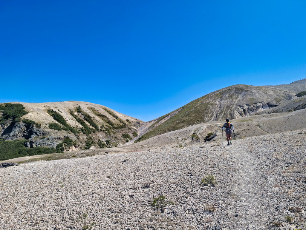
June 13, 2026: Route, Direction, and Start Time
We traveled clockwise both in 2019 and 2026, beginning at the June Lake Trailhead. This direction takes you west first, then around the north and east sides of Mount St. Helens before returning through the southeast corner and south side. I’ve posted links to Strava activity and an annotated CalTopo GPX track, with our two water stops marked, at the end of this post.
Our reason for going clockwise was simple: we wanted to finish the largest and more technical boulder fields on fresh legs.
To get ahead of the heat, we started at 4:00 a.m. Dawn was at 4:40 a.m., and sunrise was at 5:40 a.m. Surprisingly, we needed our headlamps for only the first two to three miles. By the time we entered the most serious boulder terrain, there was enough ambient light to see our footing.
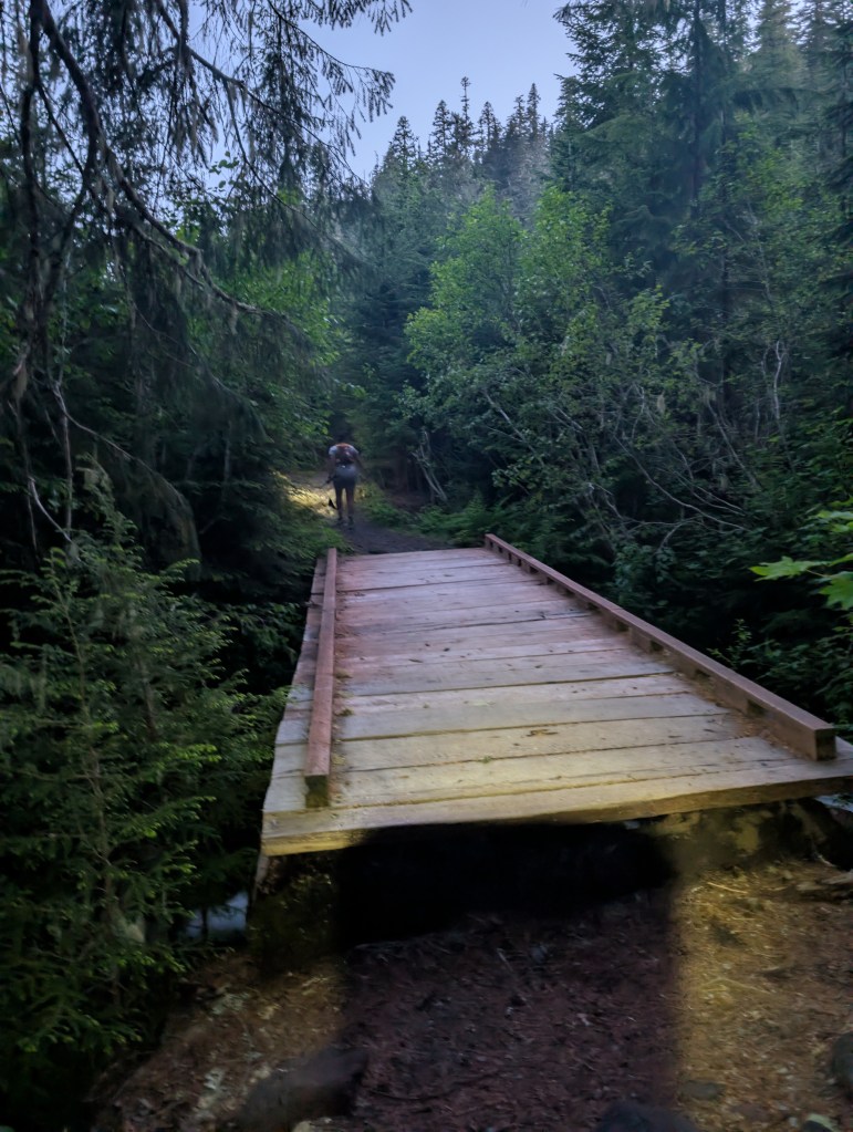
The first wooden bridge on the June Lake Trail is at mile 1.1. The rocky section begins at mile 1.7 and becomes much more serious at mile 2.
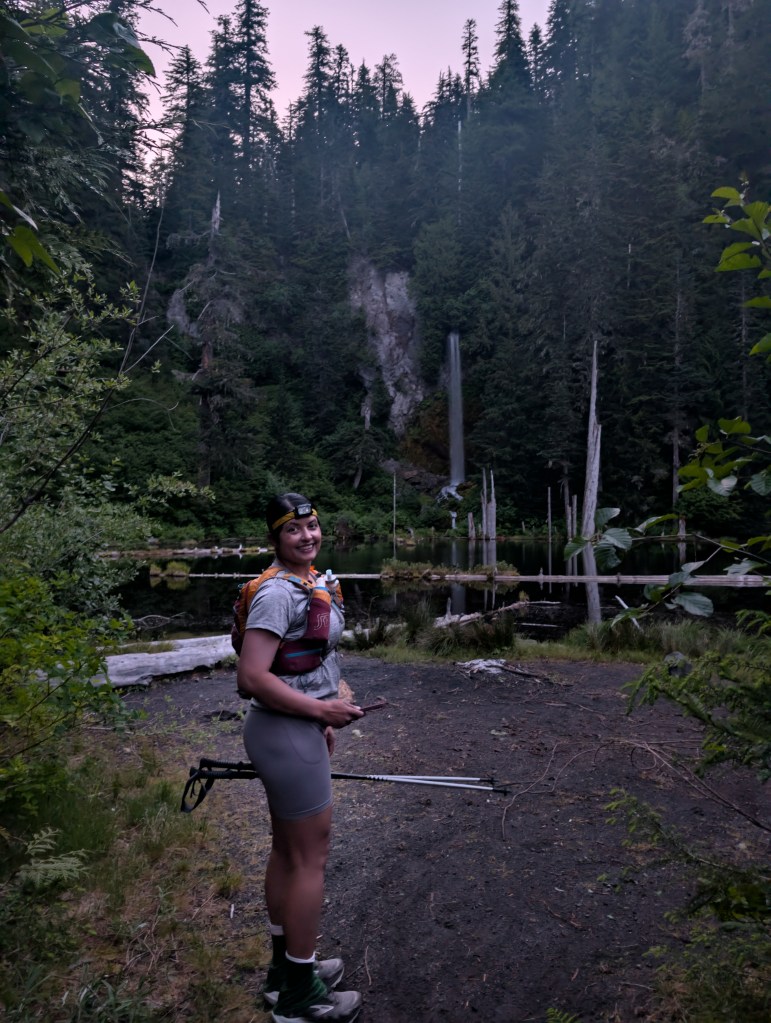
Chocolate Falls
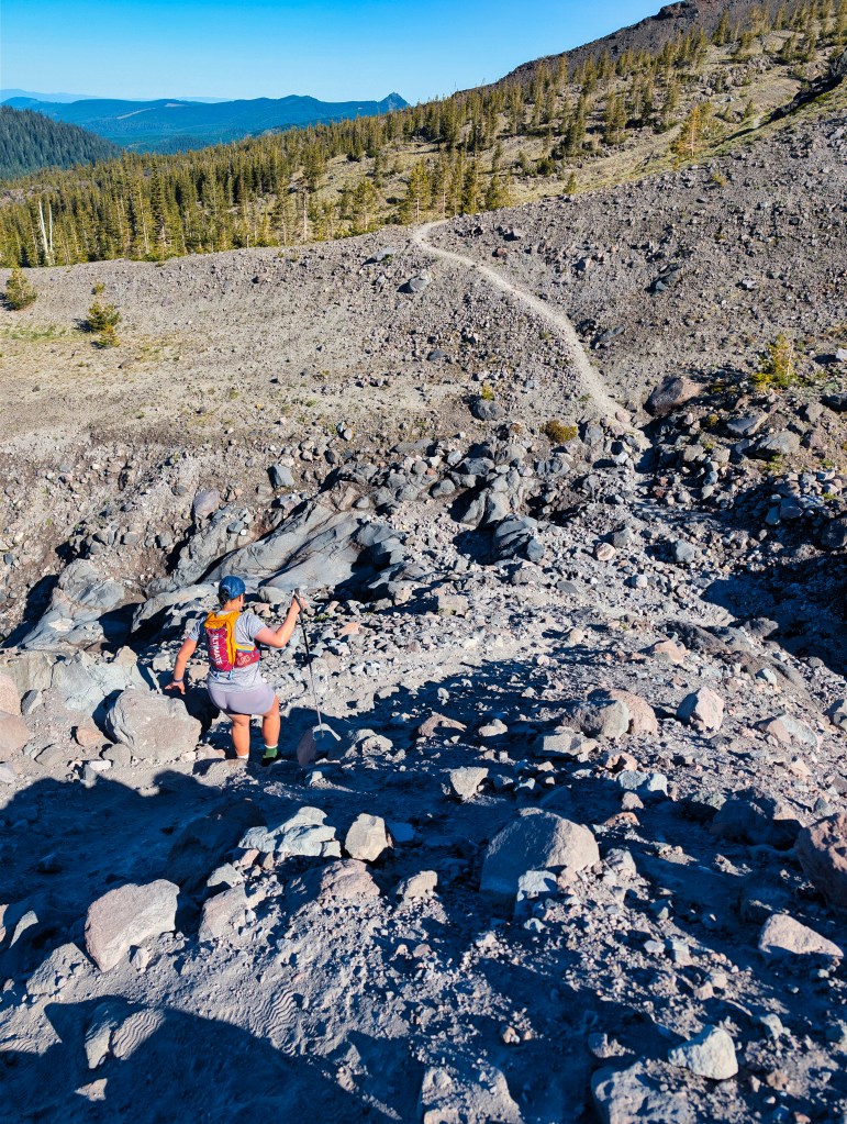
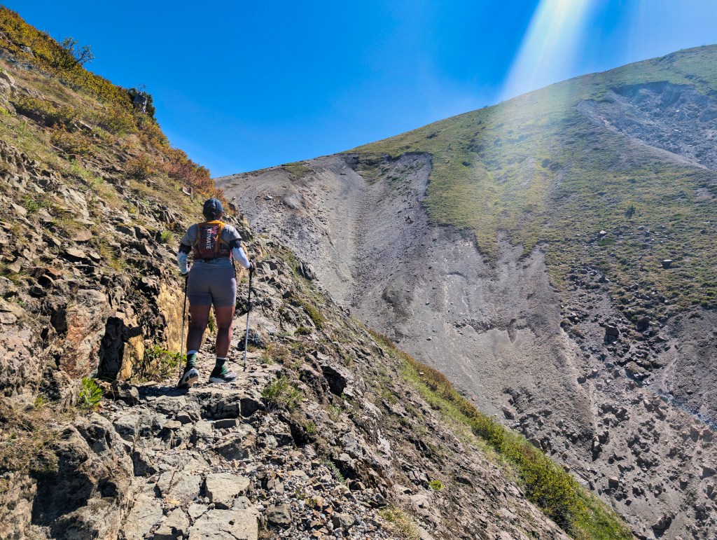
From mile 2 to mile 2.6, the route involves continuous movement across large, sharp boulders. Combined with the rocky approach, this creates close to one mile of sustained boulder travel with almost no flat surface on which to place a full foot. Progress consists of stepping along rock edges, hopping between boulders, and constantly evaluating whether the next rock intends to remain where geology left it.
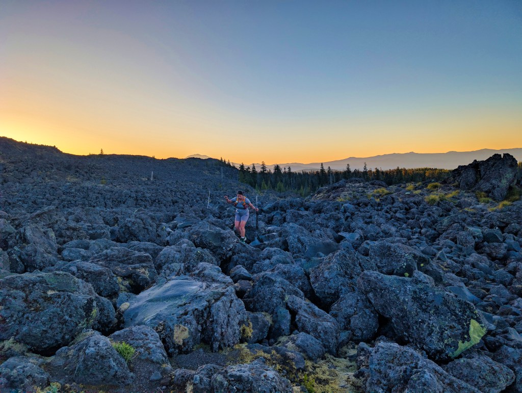
In places, the movement felt comparable to easy Class 3 scrambling. A fall in some sections could be consequential, so this is not terrain where I wanted to rush—or discover that my depth perception had taken the morning off.
The terrain finally eases at mile 2.6.
The First Five Miles: Rocks, Elevation, and More Rocks
The creek near Worm Flows was already dry. From there, we did not encounter reliable water until the South Fork Toutle River between miles 13 and 14.
A second significant boulder field begins at mile 5. This section lasts half a mile and alternates between rock hopping and fragments of recognizable trail.
During the first five miles, we gained 1,900 feet. Between the climbing, the boulders, and the constant need to place every step carefully, our early pace was considerably slower than planned. We covered the first 13 miles in 5 hours and 30 minutes. That was far slower than I had expected, and two equipment problems contributed to my growing frustration.
The first was my hair. I have long hair, so for running I braid it and then wrap the braid into a bun. That morning, I secured the final bun with a scrunchie instead of a tighter hair tie. The bun gradually loosened and repeatedly caught on small hooks attached to the top of my running vest.
The second and more consequential problem was my sunglasses. I had chosen a pair I normally wear in the city. They were not curved or wraparound glasses, and they handled the rapid transitions between direct sunlight and shade very poorly. I kept removing them to see the trail more clearly and then putting them back on because of the glare reflecting from the volcanic ground.
At mile 6, while I was adjusting the sunglasses on relatively easy rocky terrain, a large rock rolled under my foot. I lost my balance and the rock smashed my left big toe.
The pain was immediate and intense.
By then, I was already frustrated by the slow movement, the sunglasses, the loose hair, and the bun repeatedly getting caught in my vest. The toe impact tipped everything over. I sat down and had a complete meltdown—the first one I have ever had on a trail. Rick came over immediately. He asked how my foot felt and whether I could move it. He fixed my hair, and when the bun became caught in the vest hooks yet again, he took out a pair of scissors and cut the hooks off the vest. The toe pain gradually began to decrease, but I did not know whether I could continue for another 26 miles. I took two ibuprofen and started moving cautiously. Ultrarunning books often describe the strange way problems can improve if you continue moving. By mile 10, the pain had completely disappeared.
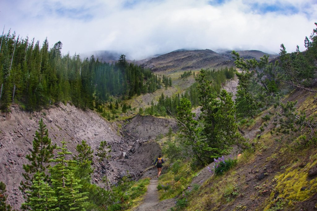
The West Side and the South Fork Toutle River
I did not write detailed trail-condition notes after our 2019 run, but I do not remember the trail being nearly this washed out, rocky, or cliffed out. Several descents and ravine crossings had barely enough room for one foot. A mistake in some of those places would not have resulted in a harmless dusty bottom. It could have resulted in a serious fall. The long descent toward the South Fork Toutle River was extremely rough and strewn with rocks. I repeatedly attempted to run it, but the uneven surface made me super protective to prevent an ankle injury. I have trained on winter versions of Portland’s Wildwood Trail, with roots, puddles, mud, and occasional snow. Loowit was harder in a different way. On Wildwood, you negotiate obstacles. On early-season Loowit, it felt as though the entire trail was the obstacle. Nearly every step required attention. A careless foot placement could easily result in a rolled ankle. We reached the South Fork Toutle River between miles 13 and 14. This was our first reliable water source of the day.
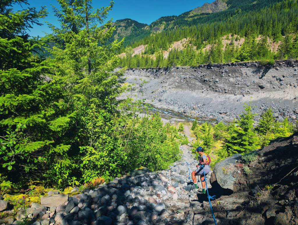
Getting down to Toutle river
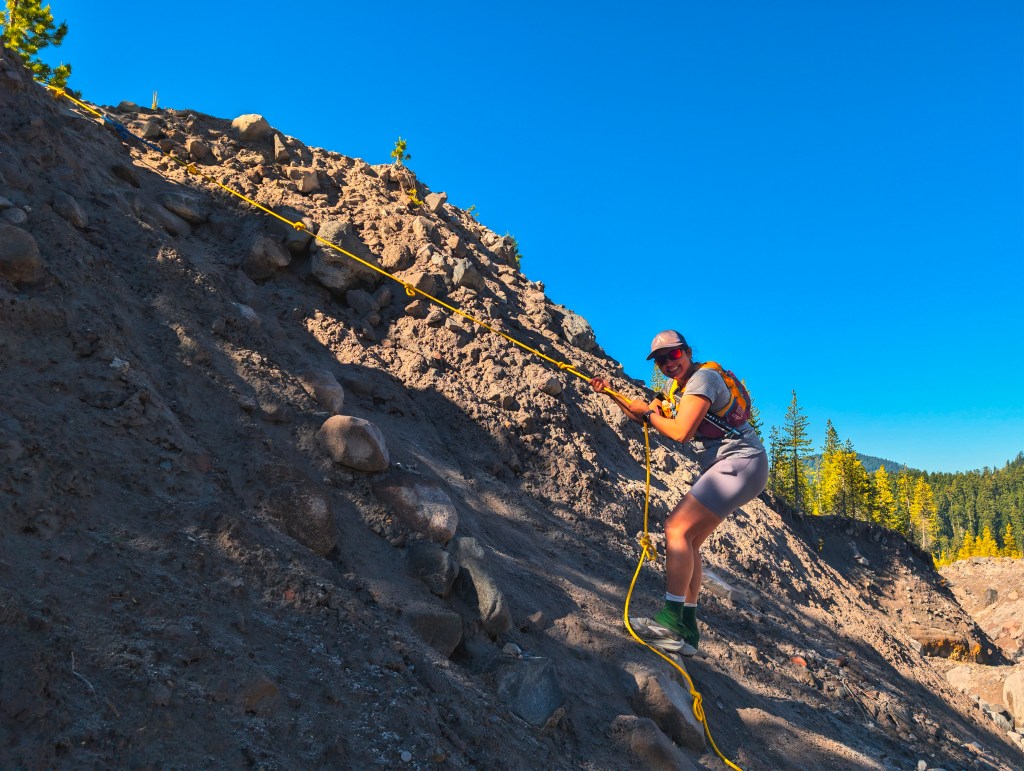
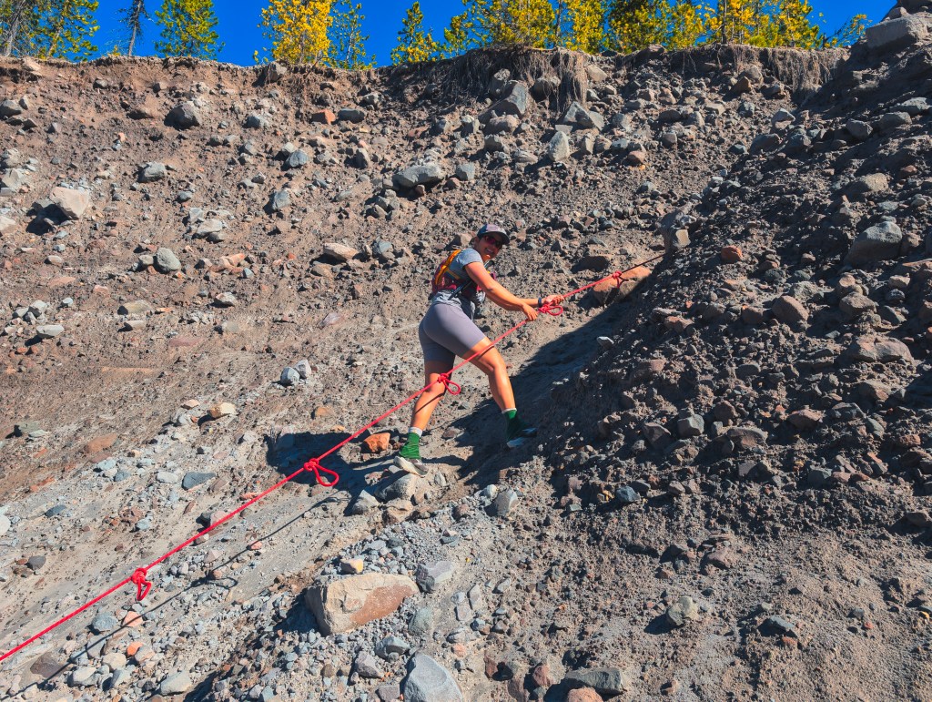
Getting to Toutle river and going up from there has ropes and we were very thankful for those.
Going up after Toutle river. This is a long hill
Water Sources
We used two primary water sources:
- South Fork Toutle River, between miles 13 and 14
- The shaded willow area after Loowit Falls, at mile 22 and before Windy Pass
We each carried one liter of water, while Rick also carried a two-liter bladder. At both major water stops, we drank heavily, filtered water, and completely refilled our capacity. At each stop, I drank more than a liter before leaving. Filtering that much water takes time, but this was not a day on which saving ten minutes by gambling with untreated water seemed intelligent. Some hikers appeared to fill their bottles directly from the stream. Everyone gets to choose their own adventure. Ours already contained enough uncertainty without adding gastrointestinal uncertainty. After Windy Pass, we crossed two additional water channels, but the water was silty, and one had almost no flow. Conditions change quickly, so future travelers should verify current water availability rather than treating our locations as guaranteed sources. The electrolyte-and-salt mixture in my left soft flask was one of the most useful things I carried. I sipped it throughout the day.
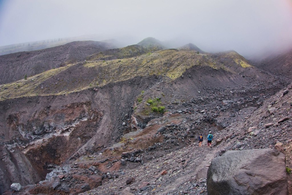
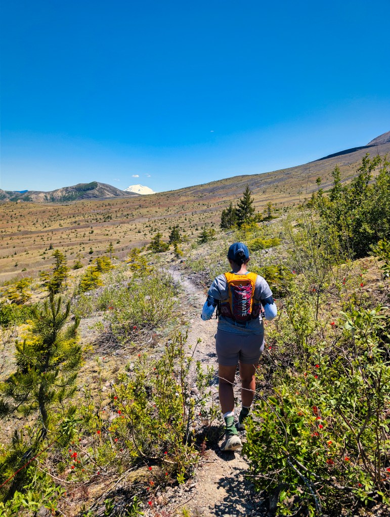
Views and the North Side
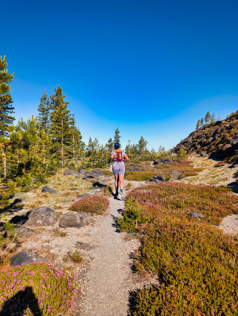
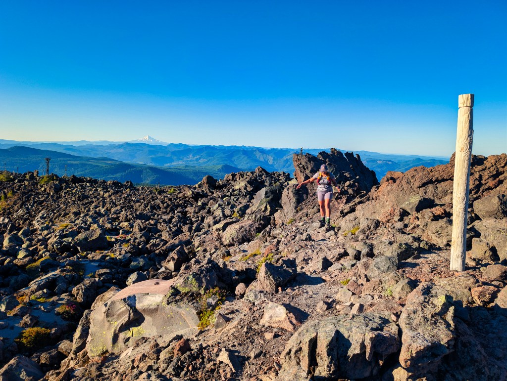
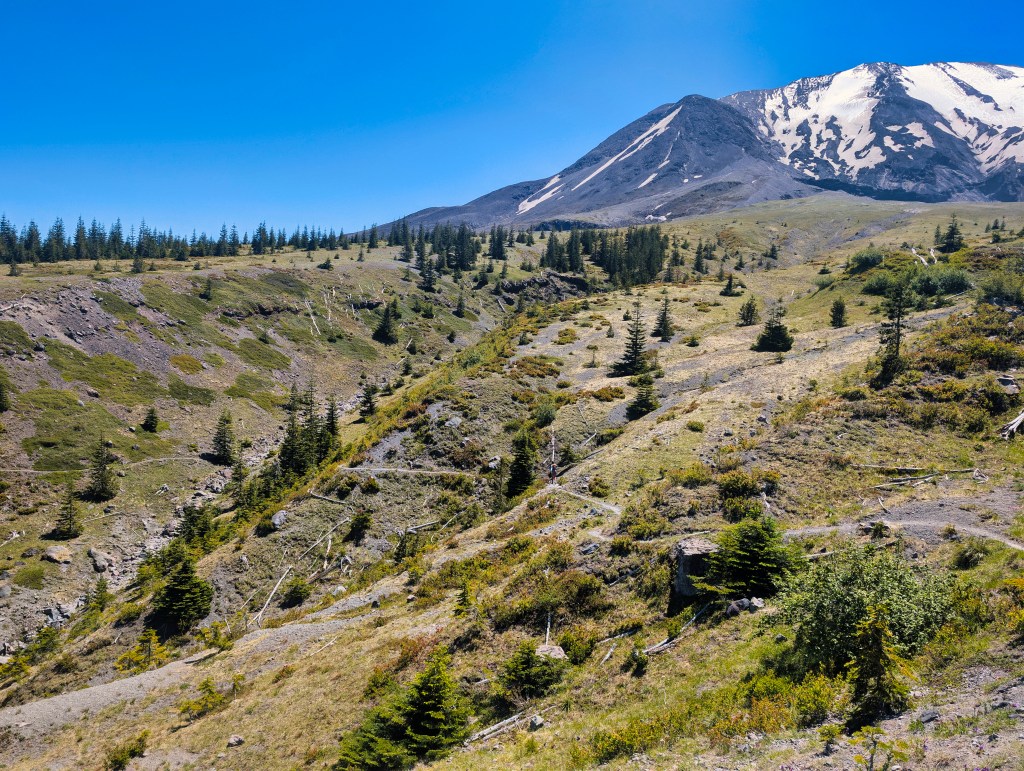
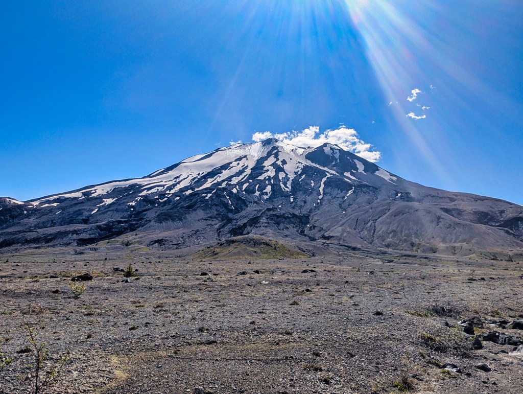
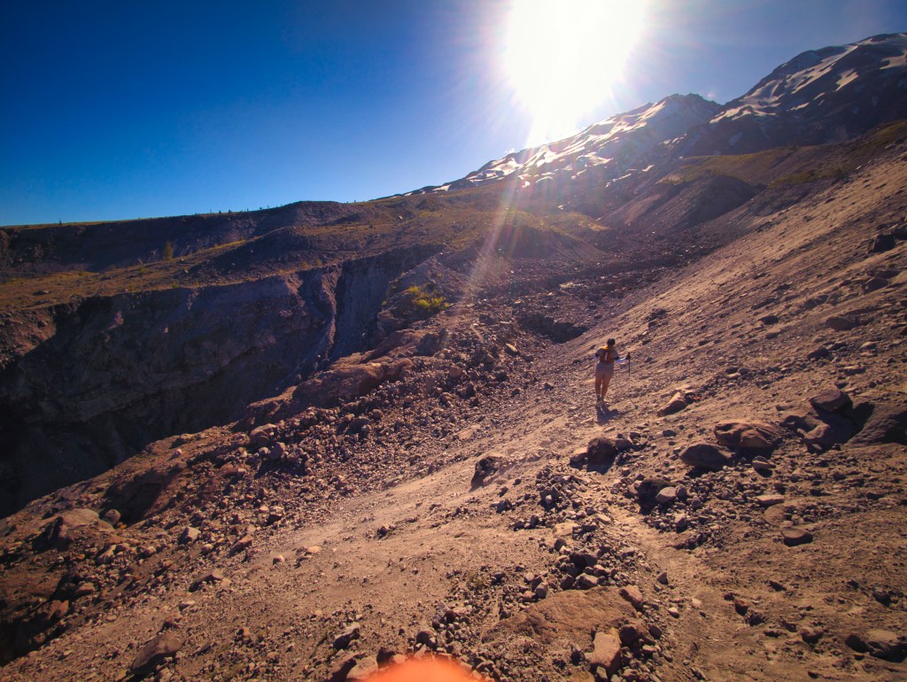
Our 2019 trip had almost no views because of the clouds and rain. This time, we saw Mount Adams, Mount Rainier, and a distant Mount Hood. The early morning sections were especially beautiful, with dramatic light across the rough volcanic terrain. The north and east sides had expansive views, but the landscape also became visually repetitive after hours of exposed travel. There were long stretches of ash, rock, ravines, and open terrain with very little shelter. In 2019, I remember being able to run substantial portions of the north and east sides. This time, I walked as quickly as I could. The northern and eastern sides are highly exposed. Although the forecast showed temperatures in the 70s, the sun-baked ash and rock reflected heat back toward us for hours. There was little relief.
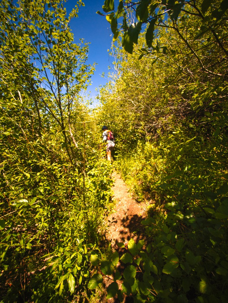
The vegetated sections were heavily overgrown. Roots and other obstacles remained hidden until they suddenly appeared beneath our feet. The trail might technically have been there, but it occasionally seemed reluctant to provide evidence.
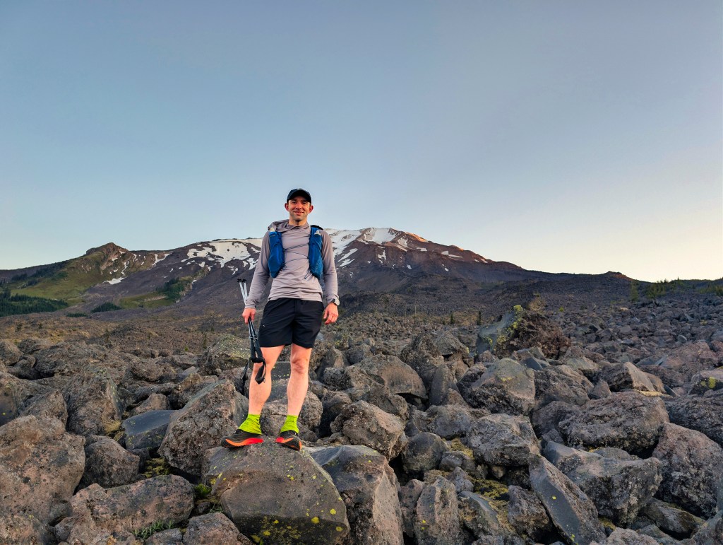
Spirit Lake in view
Cold and snowy Mt. Adams sneaking in
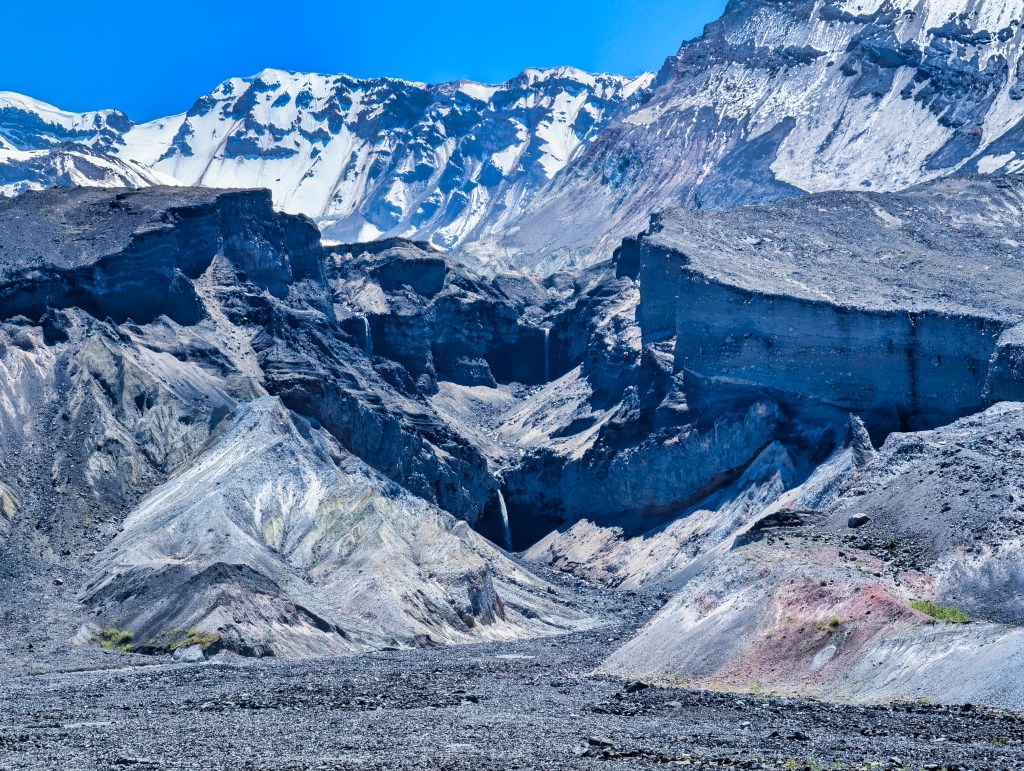
Loowit Falls area
Mt. Rainier in view
The Willows and Windy Pass
By the time we reached the shaded willow area after Loowit Falls at mile 22, several hikers were sitting beneath the vegetation in camp chairs and cooling off beside the cold water. They appeared to have discovered the finest resort on Mount St. Helens. We stopped, drank more than a liter each, filtered and refilled our water, and soaked ourselves. I walked into the stream and wet my arms, back, head, clothing, and anything else that appeared capable of holding water.
Going towards windy pass.
Almost the top of Windy Pass
Mt. St. Helens view after Windy Pass
By the time I reached the top of Windy Pass, less than a mile later, my shoes were completely dry.
That was how hot it felt.
The sandy descent from Windy Pass was steep and loose. I fell at least four times while trying to descend quickly. Fortunately, these were low-consequence falls into soft sand, mostly involving me landing on my backside and immediately pretending that had been my chosen technique.
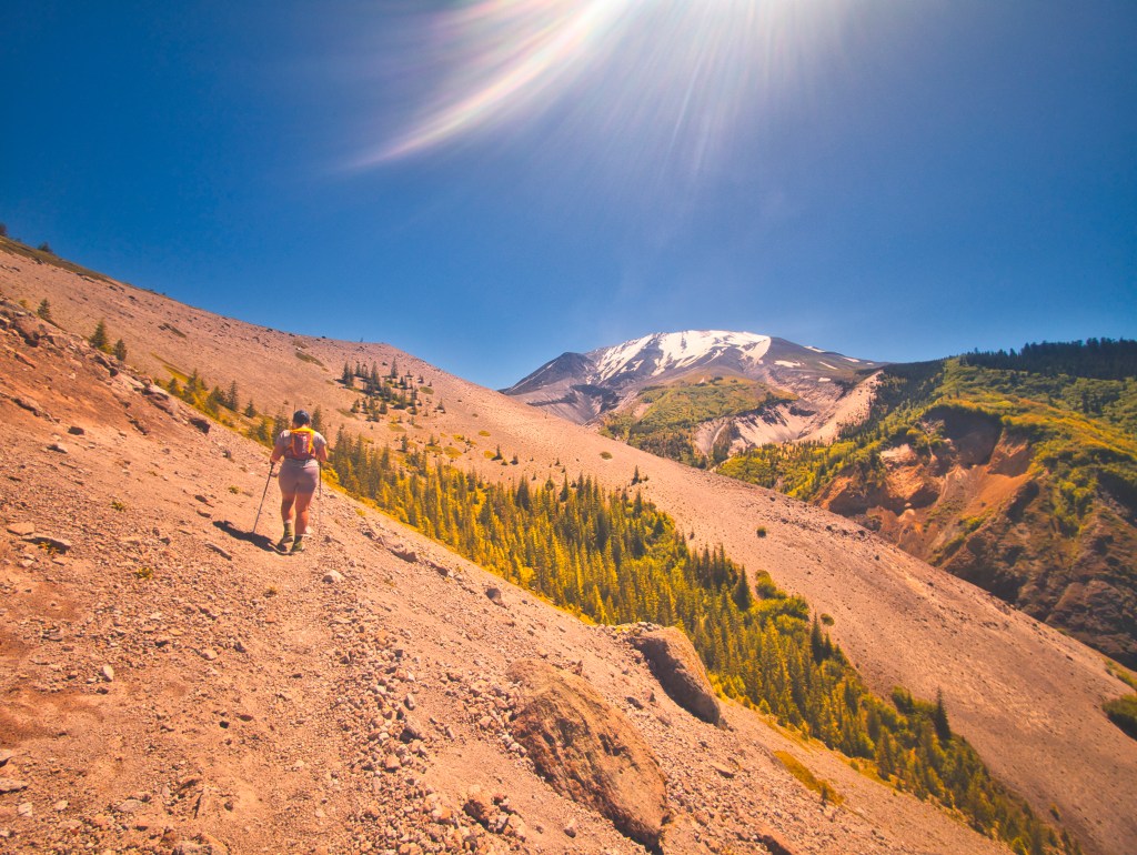
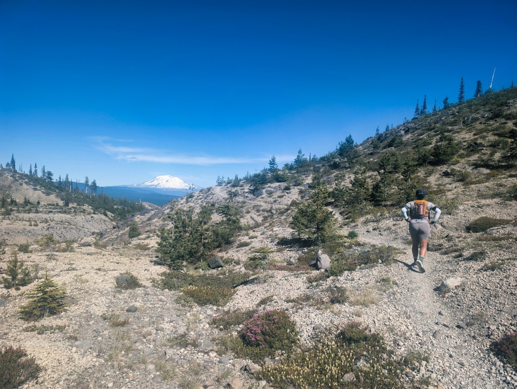
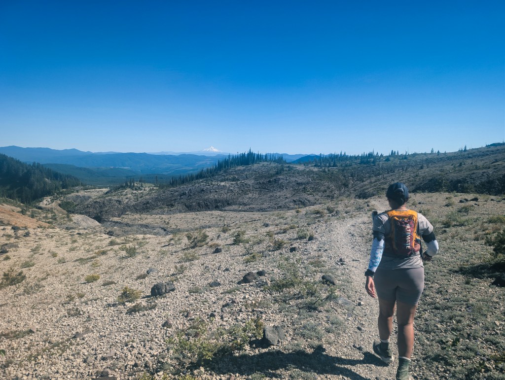
Abraham’s Plain and the East Side
We were finally able to shuffle across Abraham’s Plain at 15 minutes per mile. On a normal surface, that would not feel particularly fast. On hot sand after many hours of rocks and ravines, it felt almost like running. The heat remained intense throughout the east side. We continued moving, but our pace was governed more by heat management and technical footing than by cardiovascular fitness. Before the final four ravine crossings leading into the southeast corner and the forested south side, I became badly heat exhausted. I have had low heat tolerance since childhood. People often respond to this by saying, “But you are from India.” Perhaps I am the only Indian even I know who becomes heat exhausted while running/hiking 32.5 miles with 7,400 feet of elevation gain during a heatwave. More research may be required. At 5:00 p.m., I found the smallest available patch of shade, sat down, drank water, and ate. After 15 minutes, I felt substantially better and decided that we could continue to the car.
Going towards the shade in southeast corner/South side of the mountain. Mt. Hood is in the view. None of the ravines are in view but there are atleast four from here to the tall trees to my left.
Probably the final ravine. The trail on the opposite side (visible in pic) looked almost unreal: in places, there was room for only one foot, with a high-consequence fall below.
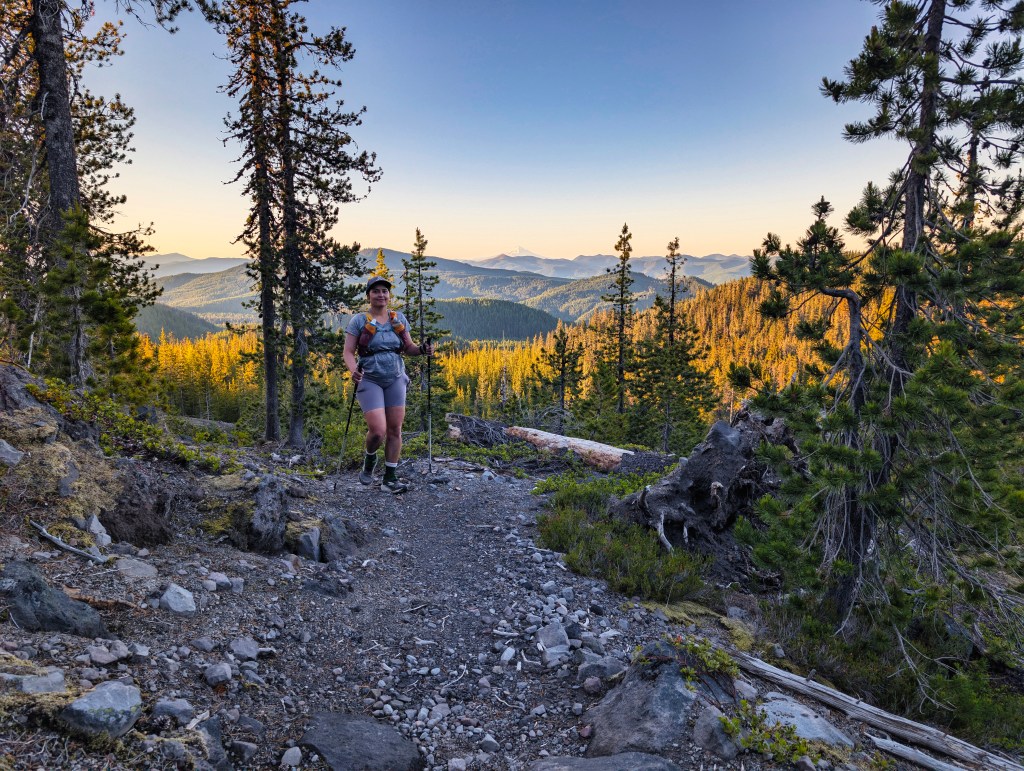
The Final Forest and Return to June Lake
Once we entered the forest on the south side, the remaining boulder terrain was comparatively mellow. The final mile of the Loowit Trail and the last 1.5 miles on the June Lake Trail were runnable. We managed 15-minute miles on the gradual descent to the trailhead. Those final miles were a reminder that we had, in fact, come here intending to run.
Time and Conditions
Our total car-to-car time was:
15 hours and 8 minutes
That was 3 hours and 23 minutes slower than our 2019 completion of 11 hours and 45 minutes.
On paper, that is a substantial difference. In practice, the two days were barely comparable.
In 2019, we had:
- A recently maintained late-summer trail
- Cool temperatures
- Cloud cover
- Light rain
- Minimal heat stress
In 2026, we had:
- An early-season trail before major maintenance
- Extended boulder fields and loose volcanic rock
- Overgrown vegetation hiding roots and obstacles
- Washed-out and exposed ravine crossings
- Very limited runnable terrain
- A regional heatwave
- Hours of direct sun and reflected heat
We could genuinely run only five or six miles of the full 32.5-mile route, although we shuffled shorter fragments wherever possible. Given the trail conditions and heat, I do not think 15 hours and 8 minutes was a terrible result. It was not the fast Loowit attempt we had imagined, but it was a serious mountain day that required patience, heat management, careful movement, and a willingness to keep going when the miles refused to disappear at a satisfying rate.
Recovery and My Current Training Ramp
Rick and I were serious runners from 2014 through the fall of 2021. I began with road running and completed five marathons, with a personal best of 4:28:46, along with 13 half marathons, one relay race, and four 50K trail races. Over time, I became less interested in organized races and more interested in training for longer, unsupported mountain runs.
In 2021, our major objective was a three-day unsupported fastpack of the Wonderland Trail around Mt. Rainier. I documented the training and the full experience here:
After Wonderland, I shifted my focus toward pushing grades in sport and traditional climbing and becoming a more confident and technically refined climber. As climbing volume increased, running mileage declined.
Annual Running Mileage
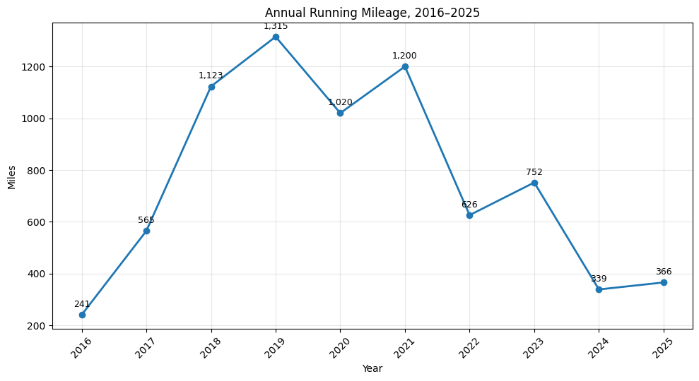
As you can see from the plot above, by 2024 and 2025, running had become secondary to climbing.
Then, in April 2026, Rick and I thought: wouldn’t it be nice to take a break from serious rock climbing and return to running? I imagined a conservative progression: 30 miles per week, then perhaps 35 a few weeks later, then 40. Even during my previous running chapter, I generally did not average more than 42 miles during my highest-volume training weeks.
That is not what happened.
Our 2026 Return-to-Running Ramp
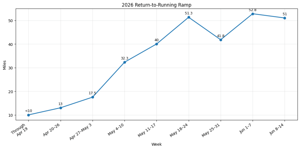
We went from running fewer than 10 miles per week to averaging 50 miles per week within eight weeks. That ramp is unbelievable to me. It is also objectively aggressive, and I am not presenting it as a sensible training template for anyone else. Somehow, however, my body has tolerated it far better than I expected. What has surprised me most is not only the mileage, but the speed of my recovery.
I can run 35 miles over a weekend, complete full-body strength training on Monday using loads up to roughly 95% of my body weight, run another total of 20 miles over Tuesday and Wednesday, and then rope climb or boulder indoors on Thursday.
That workload would have been impossible for me during my previous running chapter.
I see two major differences between then and now.
First, I have accumulated a decade of rock-climbing strength and more than three years of consistent weight training, including lifts up to 1.5 times my body weight. My legs, trunk, feet, and stabilizing muscles are substantially stronger than they were when I previously considered myself primarily a runner. That strength does not make every mile faster, but it appears to help me tolerate uneven terrain, awkward foot placements, long descents, and consecutive training days without breaking down.
Second, after 27 years as a strict vegetarian, I added chicken to my diet. This was a personally difficult transition, but I suspect that increasing my protein intake and making complete recovery meals easier has contributed to my improved muscle recovery.
This is not a controlled scientific experiment. It is an observation from a sample size of one—and the subject is known to make questionable decisions involving volcanoes.
Still, the difference feels unmistakable.
The 2026 version of me is not simply returning to the runner I was in 2019 or 2021. I am returning with years of climbing movement, considerably more strength, and a body that appears able to recover from mountain mileage much faster than it did before.
Loowit was slower, hotter, rougher, and less runnable than we expected. It was also evidence that my body can now absorb a demanding effort, recover quickly, and return to training without the prolonged breakdown I experienced during my earlier running years. We did not achieve our time goal. We did complete 32.5 miles around Mount St. Helens during a heatwave, manage the water and exposure, and feel surprisingly functional the next day. I will take that result.
Activity and Route Information
Strava activity:
https://www.strava.com/activities/18911367361
Annotated GPX track and water-source map:
https://caltopo.com/m/BJC3538
