Sandy:
Logistics
| Item | Value |
| Date started and finished | June 20, 2026 |
| Distance | 50 miles |
| Elevation gain | 8208 feet |
| Style | Unsupported day effort |
| Elapsed time | 17 hrs 26 minutes 12 seconds (https://www.strava.com/activities/19005196107) |
| Average pace | 20:46 minutes/mile |
| Start time | 5 am |
| Finish time | 10:26 pm |
| Direction | Counterclockwise |
| Trailhead | Devil’s lake trailhead |
| Water carried per person | 1L (0.5L salt and electrolyte, 0.5L water with filter) |
| Other gear | ultralight trekking poles, light wind blocker, food, sunblock, insect repellant |
Backstory
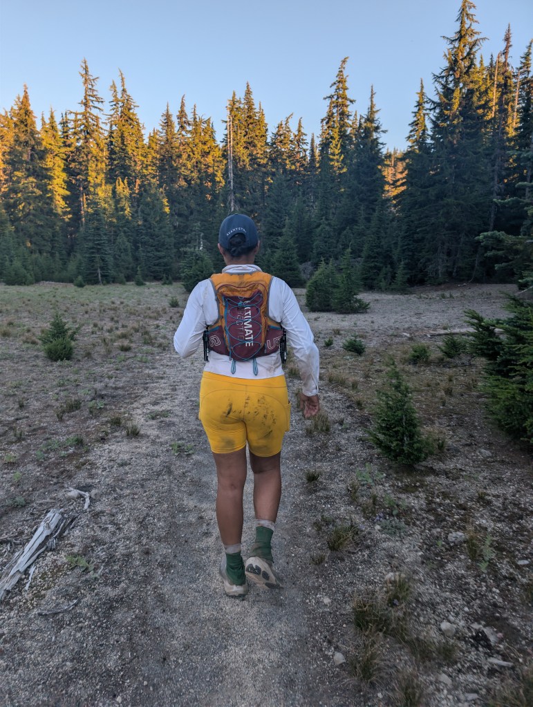
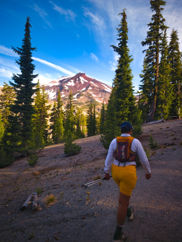
After completing the Loowit Trail during a heat wave, we were ready for two things: a smoother trail and cooler temperatures. Preferably both at the same time. We have done several routes in the Sisters area, including the Broken Top Loop, the Three Fingered Jack Loop, a run near the headwaters of the Metolius River, and an up-and-down of Black Butte. Farther north, we have run the Loowit Trail around Mount St. Helens, the Timberline Trail around Mount Hood, the Wonderland Trail around Mount Rainier, and the Grand Loop in Olympic National Park. Compared with those routes, the trails around the Sisters generally feel remarkably smooth, well graded, and runnable—and the views are phenomenal. Of all the major volcano circumnavigations we have completed, Loowit is probably the least scenic to me. It is dramatic, rugged, and memorable, but the Three Sisters Loop delivers a greater variety of lakes, creeks, forests, burn zones, lava fields, and close-up mountain views. Before this trip, the farthest I had covered in a single day was 43.4 miles, so the idea of completing 50 miles still felt intimidating. However, our Grand Loop outing had been nearly 47 miles with 13,027 feet of elevation gain. In comparison, the Three Sisters Loop—with 8,028 feet of gain and significantly more runnable terrain—seemed almost relaxed. “Relaxed,” of course, is a relative term when the plan still involves moving for 50 miles in a day.
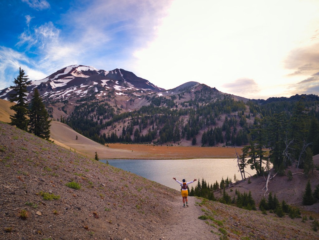
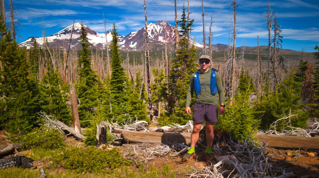
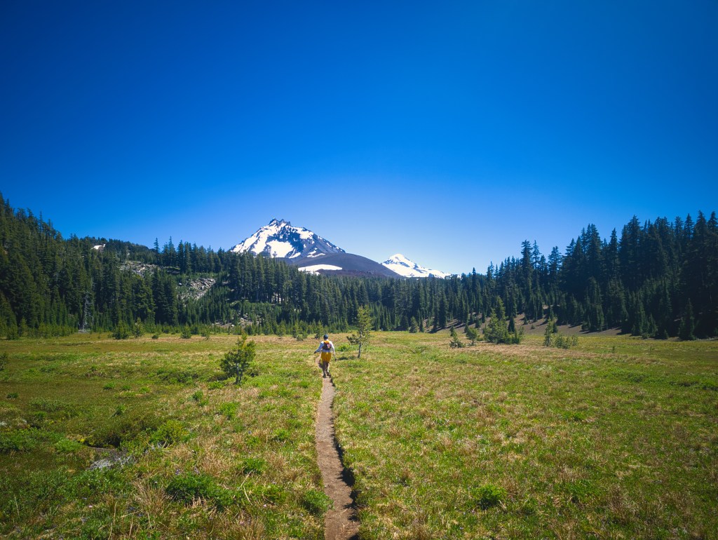
The Run: South and Southeast: Water, Green Lakes, and Early Miles
The entire loop is spectacular, but three areas stood out to me:
- The south side near South Sister and Green Lakes
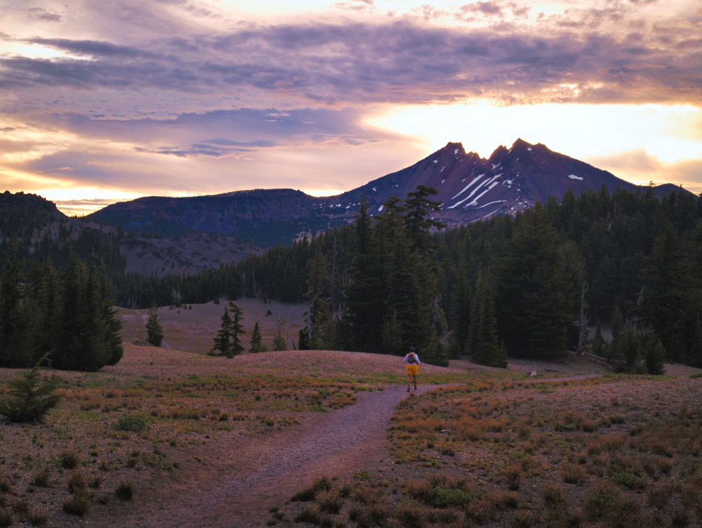
- The eastern burn area, where Middle and North Sisters dominate the skyline
- The high point on the northwest side, where a clear day reveals a long chain of Cascade volcanoes
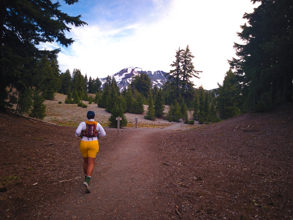
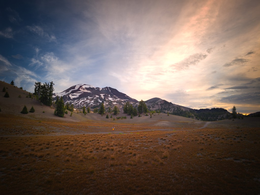
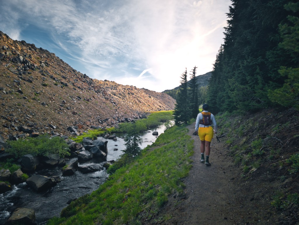
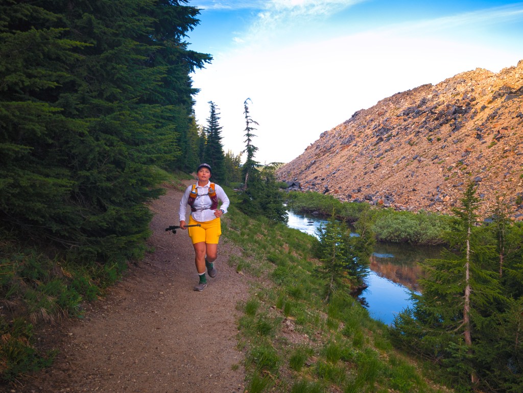
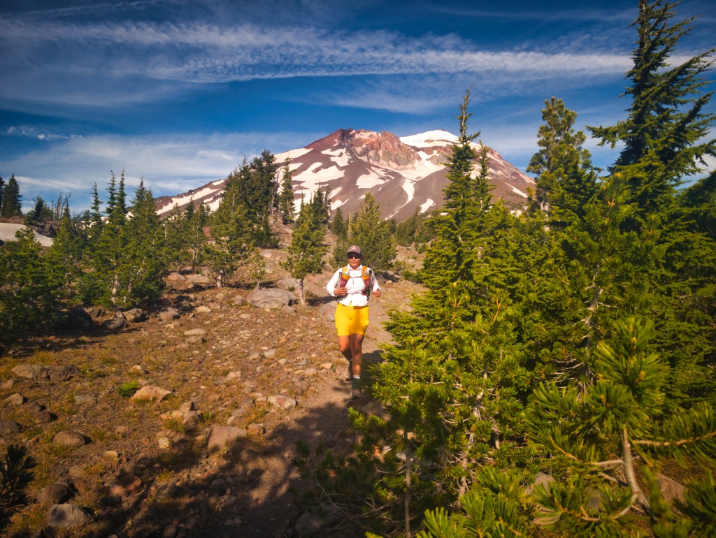
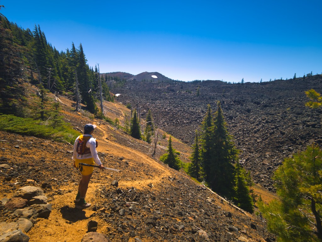
We started at the Devils Lake Trailhead and traveled counterclockwise. For approximately the first 13 miles, we passed numerous streams, lakes, and other potential water sources. Water availability can change substantially from year to year and between early and late season, so our observations apply specifically to June 20, 2026. A stream flowing strongly in June may be little more than an optimistic line on a map by August. The early miles were pleasant and runnable, with frequent water and increasingly impressive views around South Sister and Green Lakes. After the punishment of Loowit, the trail almost felt suspiciously civilized.
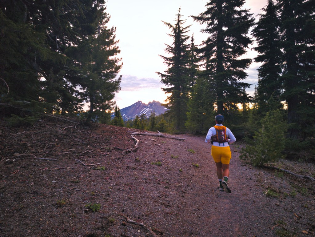
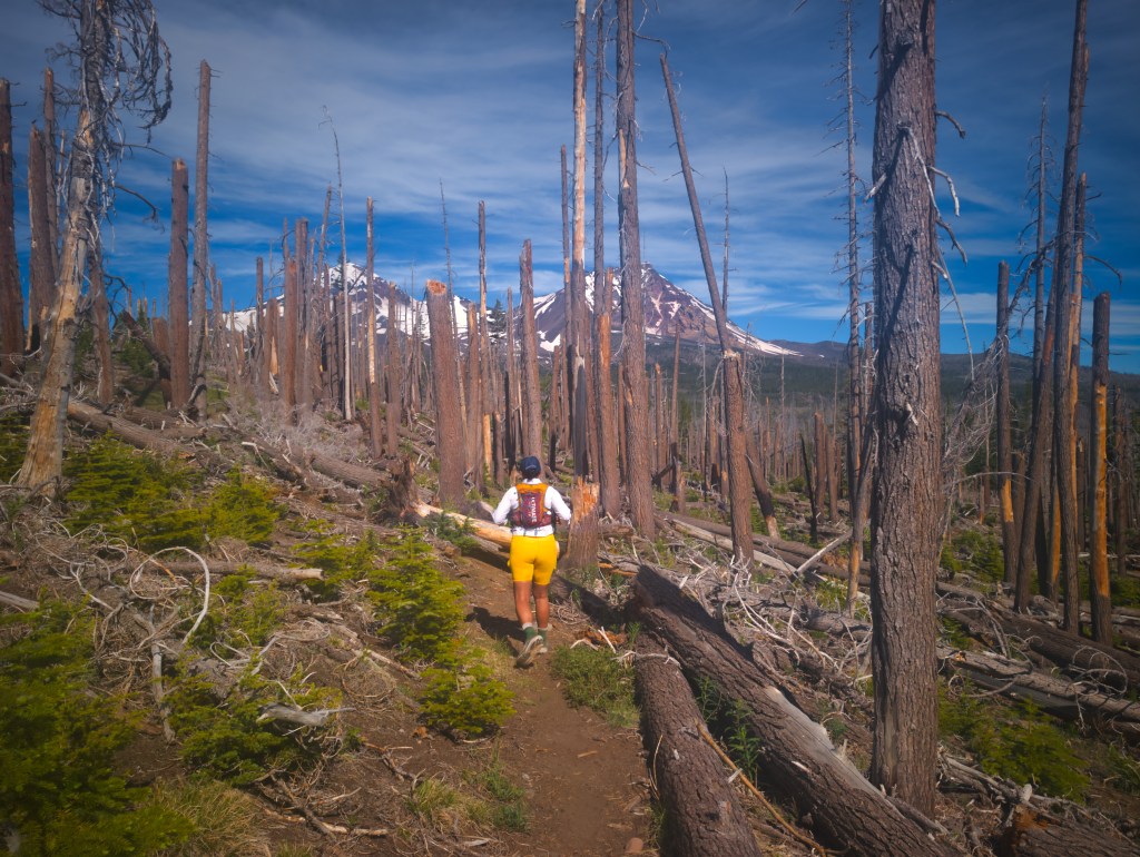
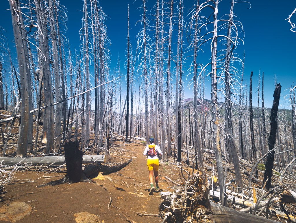
East and Northeast: Burn Zone and Big Views
The eastern side passes through a broad burn area with little shade. The open landscape provides excellent views of Middle and North Sisters, but it also leaves runners fully exposed to the sun and wind. We reached this section around 10:00 a.m. Although the temperature remained below 70°F and a cool breeze was blowing, we could still feel the heat. With little shade and no protection from direct sunlight, the eastern side felt warmer than the forecast suggested. We moved efficiently through it to minimize our exposure. For the first 32 miles, we maintained an elapsed average of approximately three miles per hour. That included water filtering, brief stops, and a 20-minute lunch break. At approximately mile 26—about one mile before South Matthieu Lake—we found shade and stopped for lunch. We promptly demolished a six-inch chicken teriyaki Subway sandwich. After more eight hours of running, it qualified as fine dining. When we reached South Matthieu Lake at approximately mile 27, Rick and I each had around 0.7 liters of water remaining. We had finished the main burn section, so we assumed that would be enough and decided not to refill. That was a mistake.
The next water we personally confirmed was nearly 12 miles away.There were a few blowdowns in this northeastern section, but they were minor compared with what awaited us later on the southwest side.
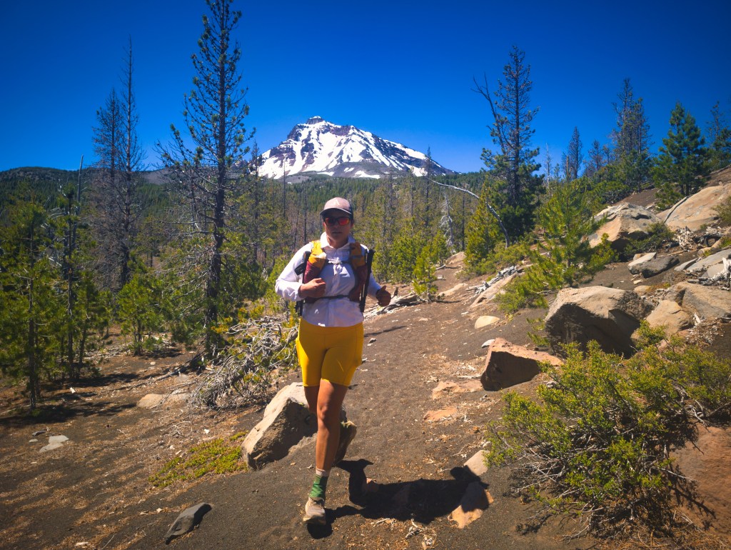
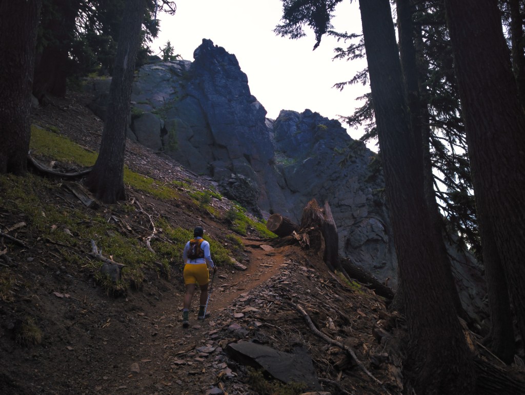
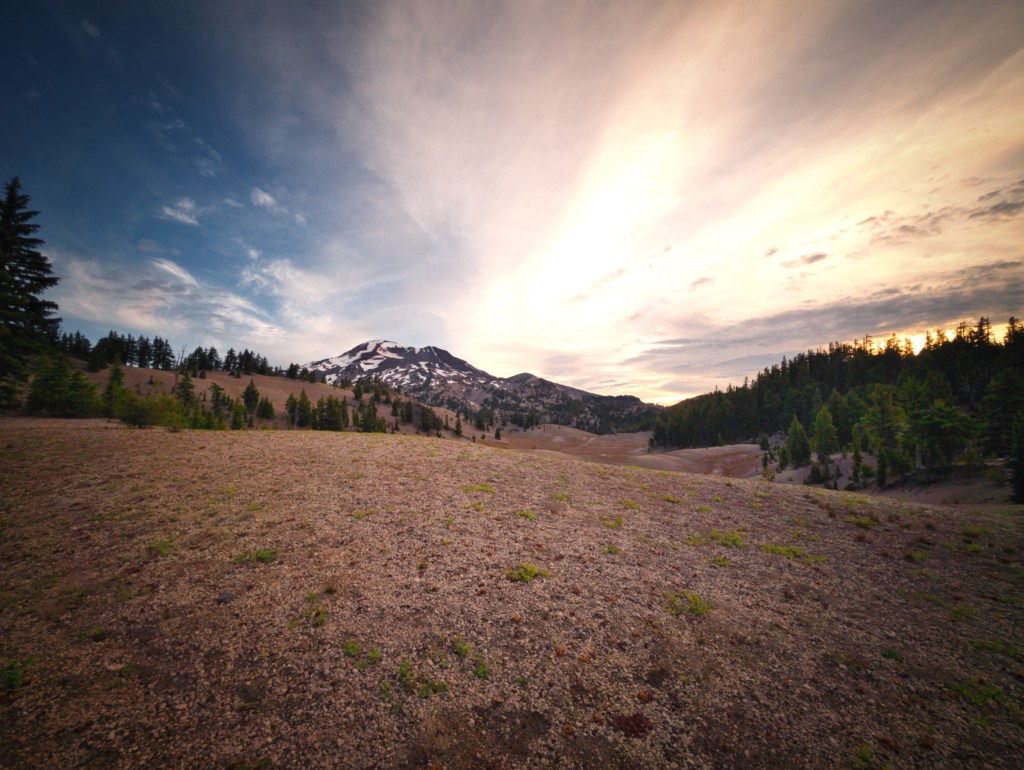
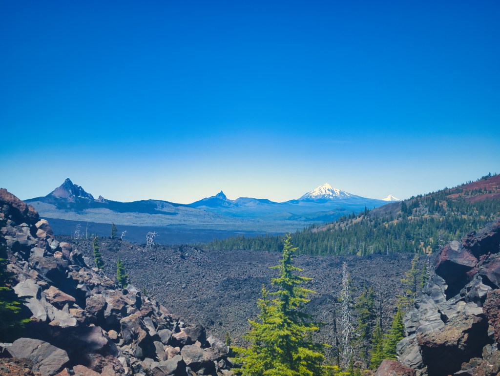
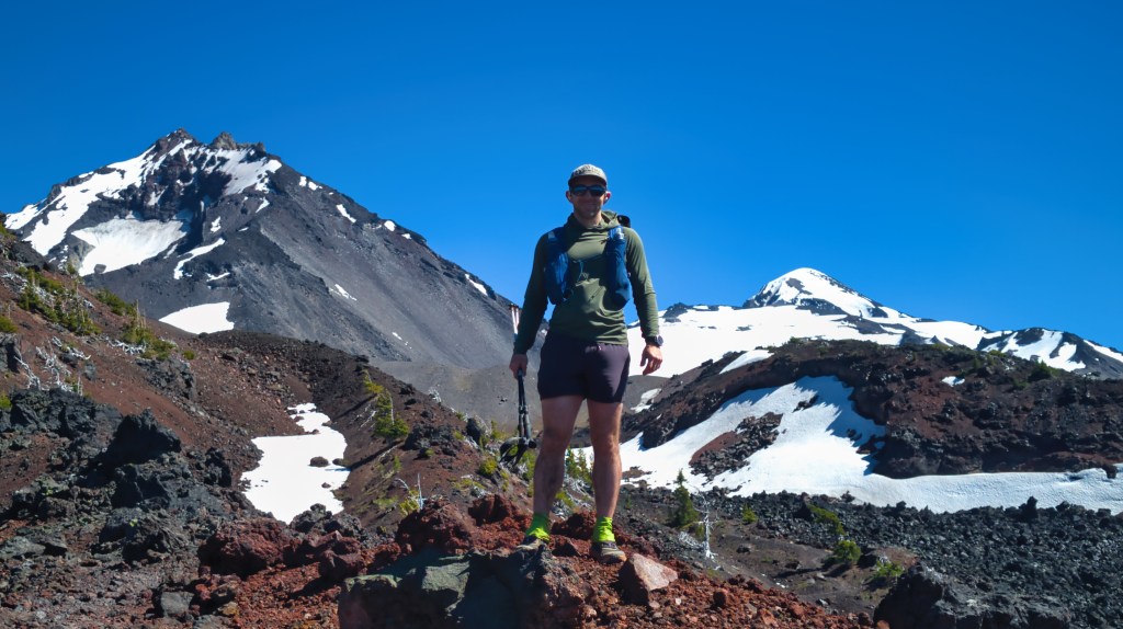
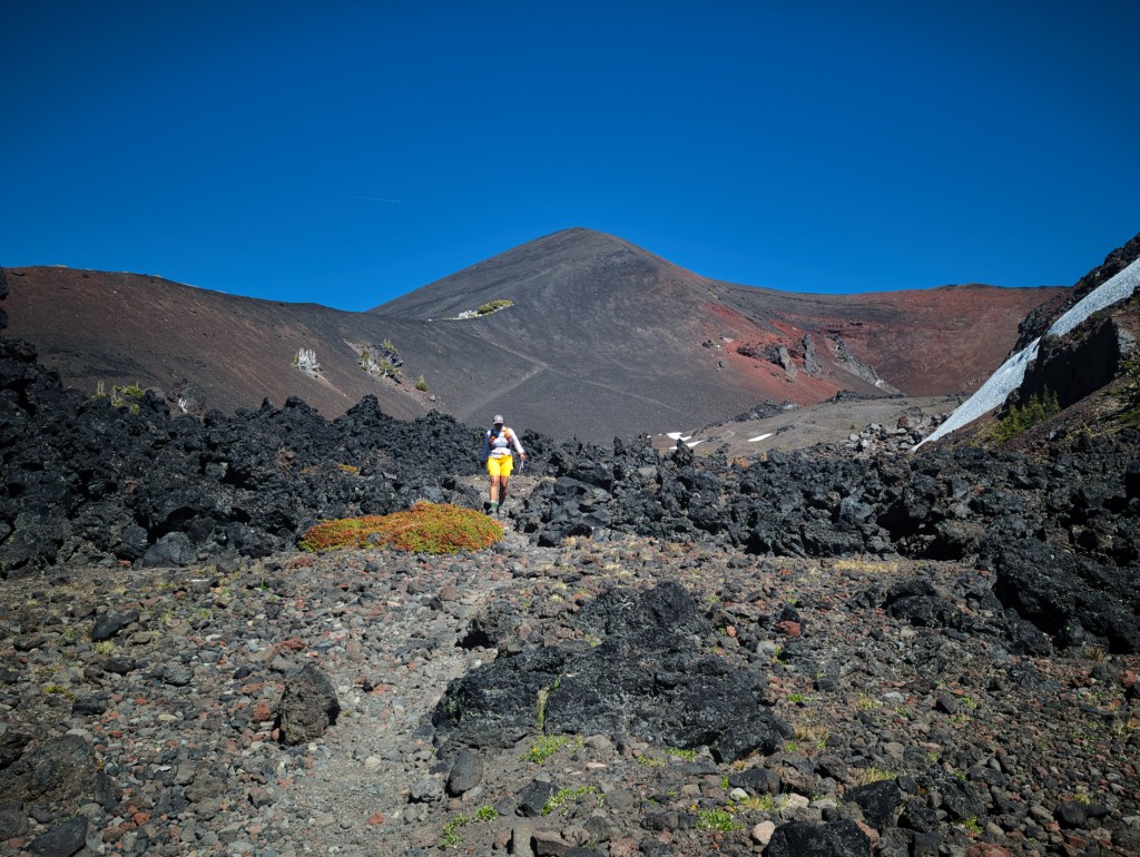
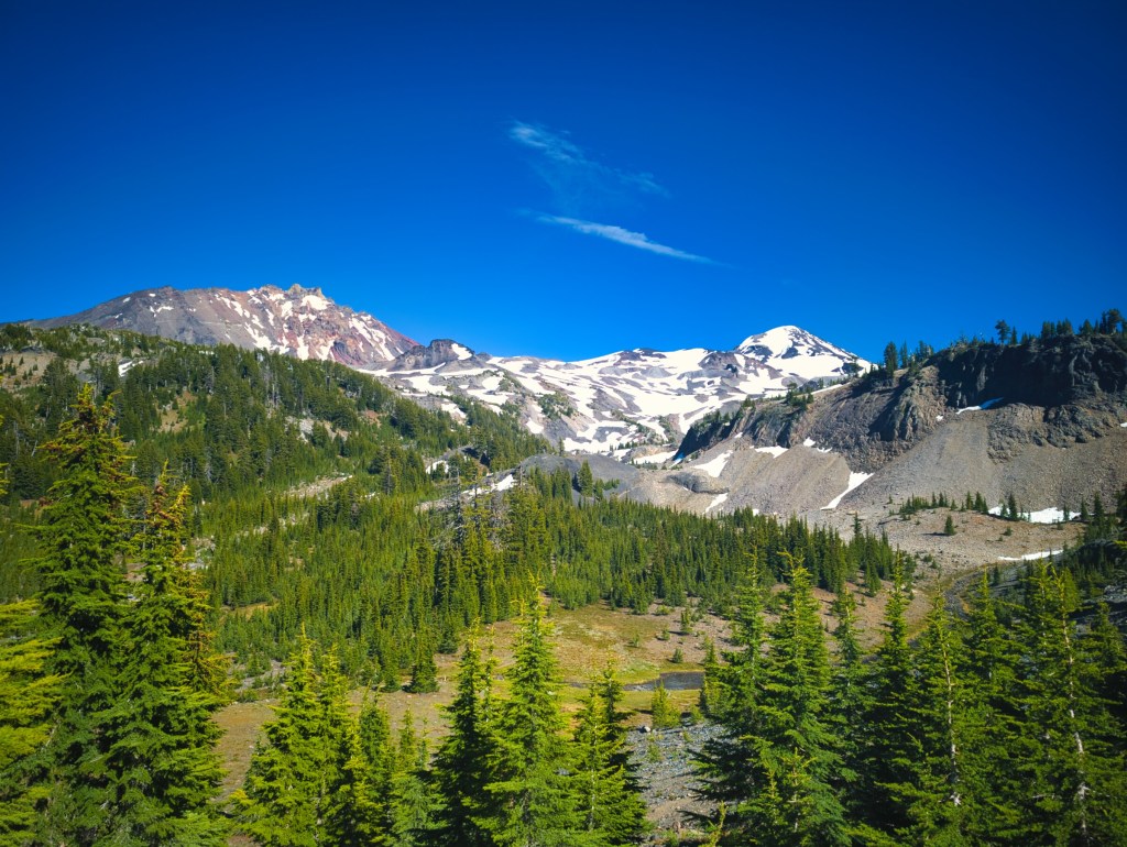
North and Northwest: Volcanic Rock, Heat, and Emergency Snow Cones
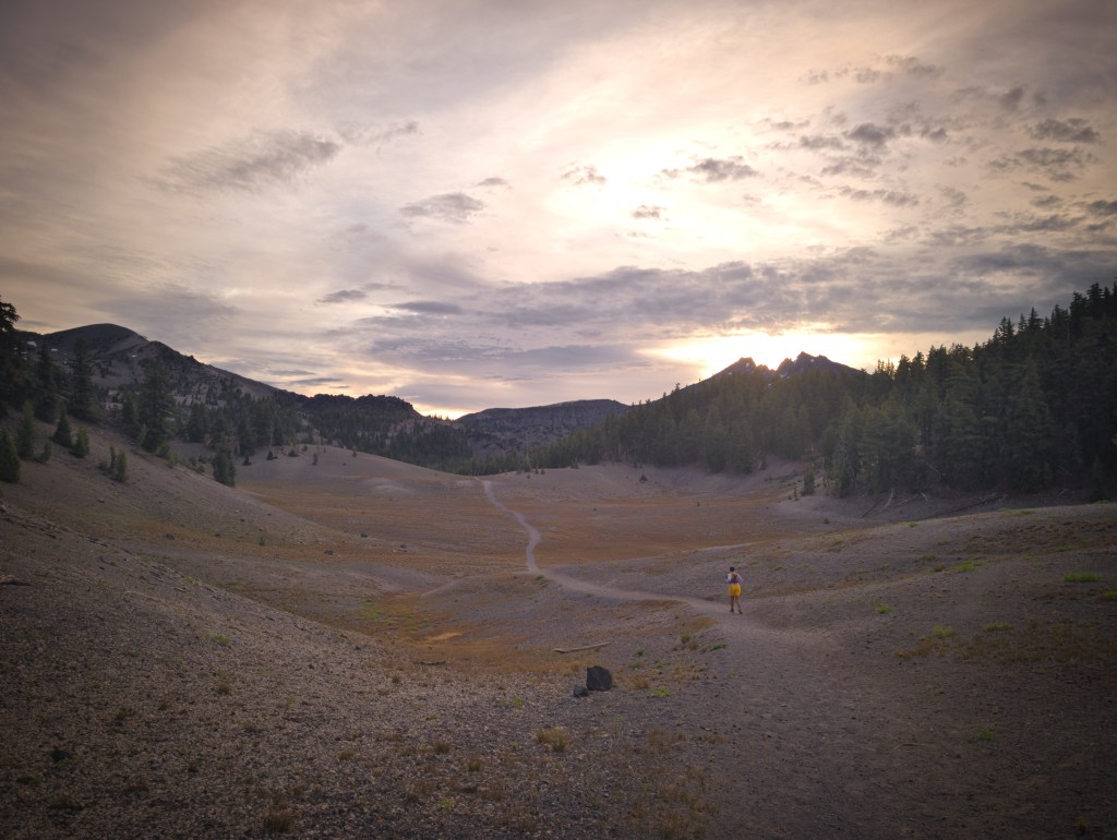
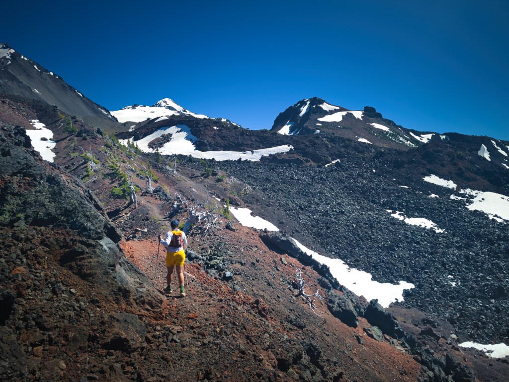
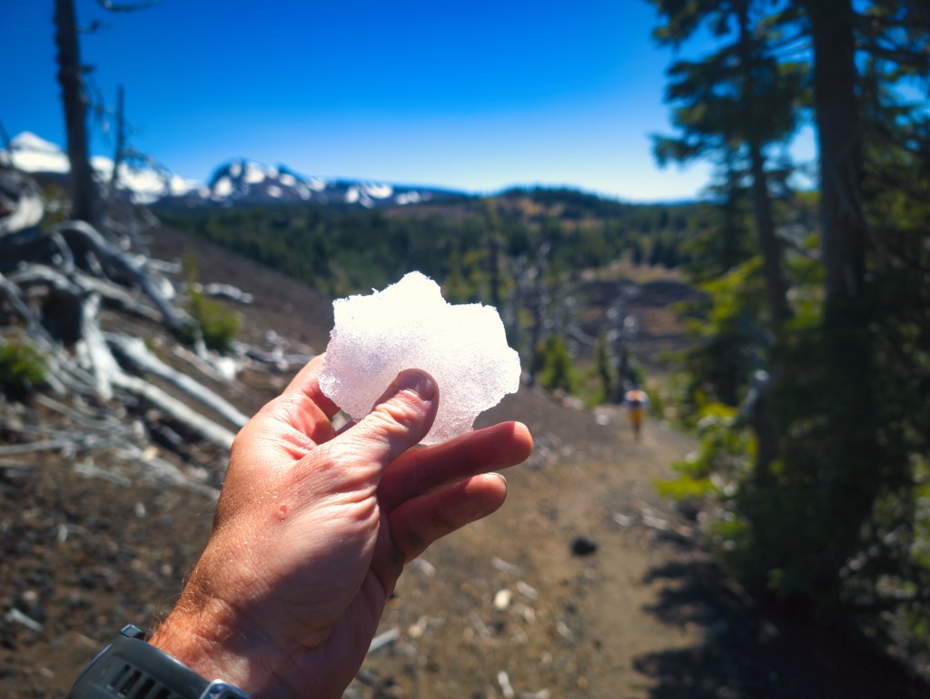
Immediately after South Matthieu Lake, the character of the route changed. The next several miles crossed rough, exposed volcanic terrain. The ground was rocky, dark, and largely uncovered by soil. Rick wondered how dirt had not managed to cover the rocks after hundreds—or perhaps thousands—of years. This section was both rocky and exposed. Heat radiated from the dark rock, making the air feel much warmer than the actual temperature. Fortunately, a cool 10 mph breeze offered some relief. Because we had skipped the water refill at South Matthieu Lake, our remaining supply was becoming increasingly precious. At approximately mile 32, we reached the high point of the loop and one of its finest viewpoints. On a clear day, the northern horizon includes Mount Washington, Three Fingered Jack, Mount Jefferson, Mount Hood, and even faintly visible Mount St. Helens. Near one of the final climbs in this rocky northwestern section, a patch of clean snow remained beside the trail. Rick stopped and added some snow to his water. I continued climbing uphill, hot and increasingly miserable. A little later, he caught up carrying two improvised snow cones. He was eating one and had brought the other for me. I put mine against the back of my neck and inside my shirt, and the combination of snow and wind cooled me almost immediately. After overheating on the exposed climb, I suddenly felt energetic again. I also ate part of Rick’s snow cone, because apparently we had reached the stage of the outing where trail snow counted as both hydration and dessert. At one point, I saw Rick slide on the rocky trail. His primary concern was not whether he had fallen, but whether he had protected the snow cone. He had. Priorities become very clear after 30 miles.
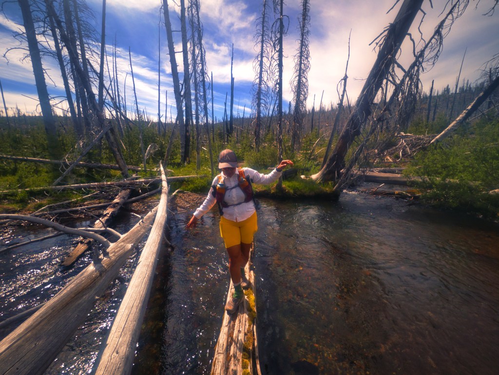
West and Southwest: The Search for Water
After the snow revived us, I asked an approaching hiker where we might find the next water source. He told us there was a small stream approximately one mile ahead. A mile later, we found only dry creek beds. Based on our map and the nearby signs, we were likely in the Obsidian area, but none of the channels we crossed contained water. We eventually found a small amount of flow at approximately mile 39, which appeared to be Linton Creek. The flow was minimal and looked as though it could disappear later in the season. We found another trail-crossing stream afterward with a healthier amount of water. Reese Lake, at approximately mile 40 on our route, provided another obvious water source. Apart from these sources, much of the western side was dry during our trip.
The lesson was simple: we should have refilled at South Matthieu Lake. Late in the season, even runners should consider carrying a little extra water from this point.
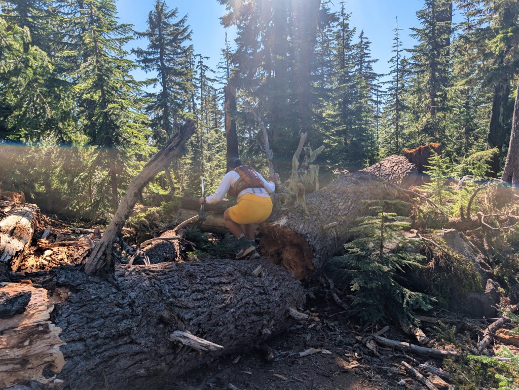
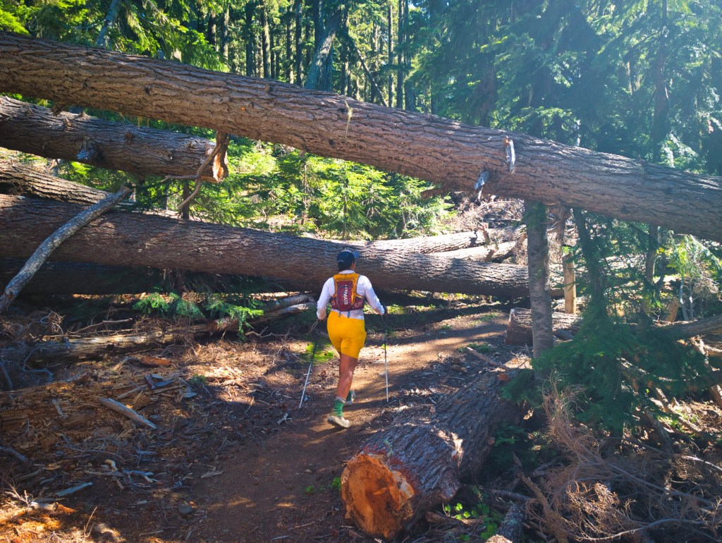
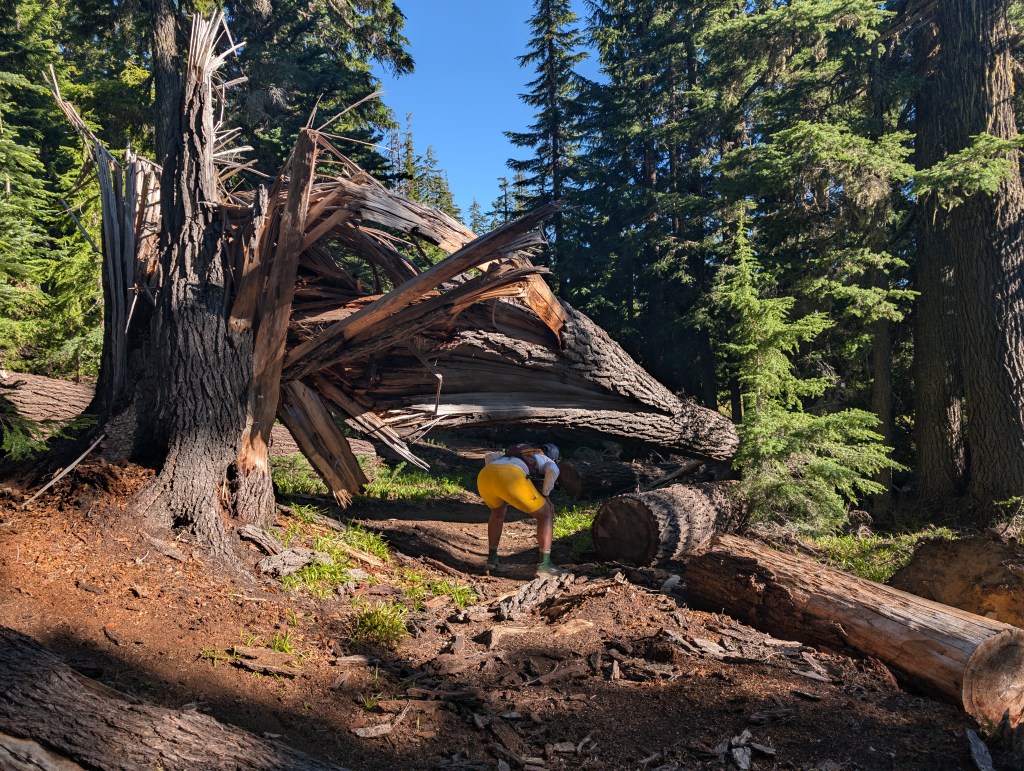
Blowdowns: Miles 36–45
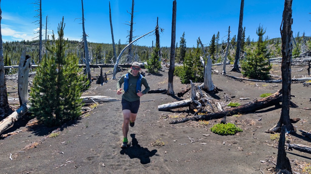
From approximately mile 36 through mile 45, the blowdowns became frequent and increasingly awkward. Some were straightforward step-overs. Others required climbing, crawling, detouring, or carefully threading ourselves through branches. By then, we had already completed a substantial amount of running. Every additional tree at miles 43 and 44 registered clearly in our legs. We began wondering how backpackers carrying heavy loads managed to negotiate the same obstacles, especially after several consecutive days on the trail. With small running packs, we could climb over or squeeze underneath most of them. A large overnight pack would make some of those maneuvers considerably less elegant. Hopefully, trail crews will eventually clear this section. Until then, the forest has installed its own obstacle course at no additional charge. Earlier in the day, near the beginning of the southeastern burn area, we had passed a backpacker carrying impressively light gear. We saw him again around mile 37. As we approached, he politely stepped aside to let us run past.
I stopped and said, “Hey, we saw you earlier!”
He recognized us and asked, “Are you guys doing the whole loop?”
When I said yes, he replied, “Jesus Christ. One super-long day.”
Technically, our super-long day still ended with more than a quarter of the day to spare.
Final Miles: Darkness and a Bonus Parking-Lot Tour
By mile 47, darkness had arrived, and I put my headlamp back on. I still need to improve my nighttime lighting system—probably by combining a headlamp with a waist lamp—because my current setup does not illuminate the trail well enough for me to run at my normal pace after dark. I was also simply tired of the running motion by then. My legs were not completely depleted; they had just submitted a formal request to do something else. I walked the final three miles at an average pace of 18:20 minutes per mile. When we finally reached the parking area, we forgot that we had parked in the lower lot. We continued all the way to the upper lot before realizing our mistake and walking back down the road.
“Rickkkkkk,” I said.
“But aren’t you happy to be walking on a smooth road for the final quarter mile after 50 miles?” he replied.
That is Rick’s particular talent: converting a navigational mistake into a complimentary positive experience.
We changed into comfortable OOFOS, opened the cooler, and retrieved sparkling water and cupcakes from Ida’s Cupcake Café. We each devoured one immediately. As we drove home, I began slowly nibbling my second cupcake. Under normal circumstances, Ida’s cupcakes can taste extremely sweet. After 50.24 miles, however, it tasted exquisite. Apparently, the ideal frosting-to-cake ratio depends entirely on how far you have run.